


产品概述
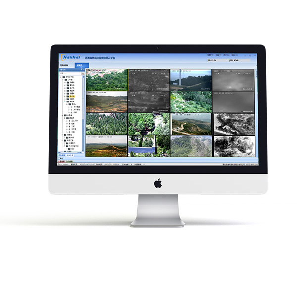
PROCUCT OVERVIEW森林防火辅助决策系统以三维GIS系统为基础平台,为指挥员提供信息化和技术层面的决策支持,通过加载森林防火重点县、保护区林业综合林业资源信息系统,将各类林业资源信息实现可视化展示。实现火情火点的精准位置、火势蔓延标绘及蔓延分析、火情视频、人员定位及移动轨迹、物资分布、重大危险源分布等各类信息的可视化展示。
森林防火辅助决策系统是一套符合林业防火业务应用的信息系统,该系统不仅为日常管理提供服务,而且一旦发生森林火灾,能够实现火灾的快速定位,及时了解详实的火场及其周围的地理和资源环境,在指挥决策系统的支持下,制定合理的扑火方案,实现扑火力量的优化配置,缩短扑火出动时间,提高扑火效率,把火灾造成的损失减少到最低限度。
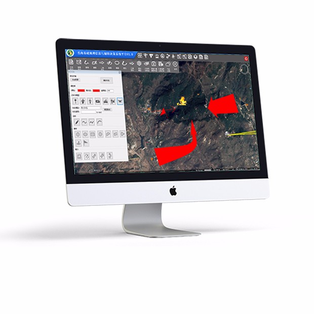
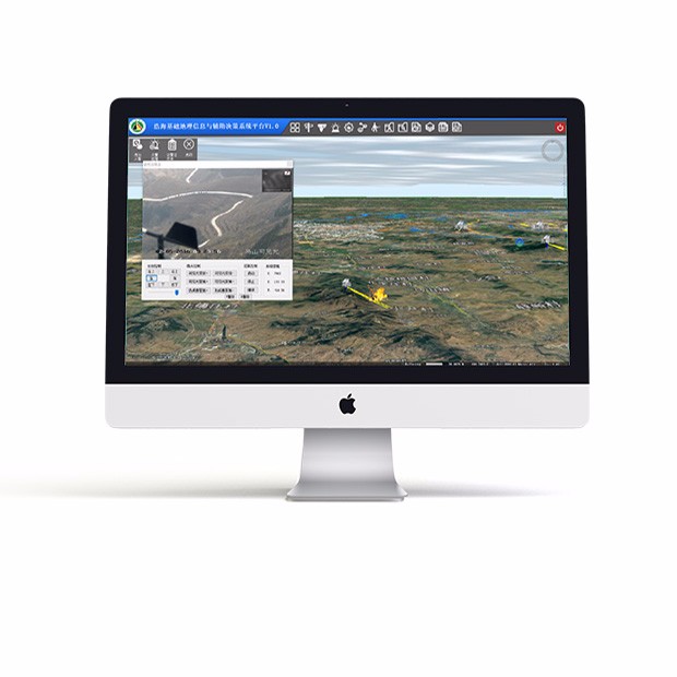
森林防火GIS辅助决策系统具有林业资源、防火因子、林权、小班数据等标绘和查询功能,支持测距、测面、通视分析操作;能够实现动态图层管理,可以增加shp等地图数据(如行政区划、河流、道路等); 具有仿真模式、观察模式、实时模式;通过GIS地图实现防火一体机无缝衔接,实时预览、云镜控制、实时信息显示;具有独特的校正算法,采用30米精度的公共高程数据可以实现火点准确定位;支持火警标绘、火势蔓延推算、动态标绘。
产品功能:
1.森林防火辅助决策系统可将所有的有关信息有机管理起来并随时调整直观形象地表现出来,确保决策指挥人员可以直观、全面的了解现场情况,并对一段时间内的态势变化进行预估展现,为防火工作的决策指挥调度提供数据支撑,进而做到决策得力,扑救有效,是指挥员决策的助手和工具。
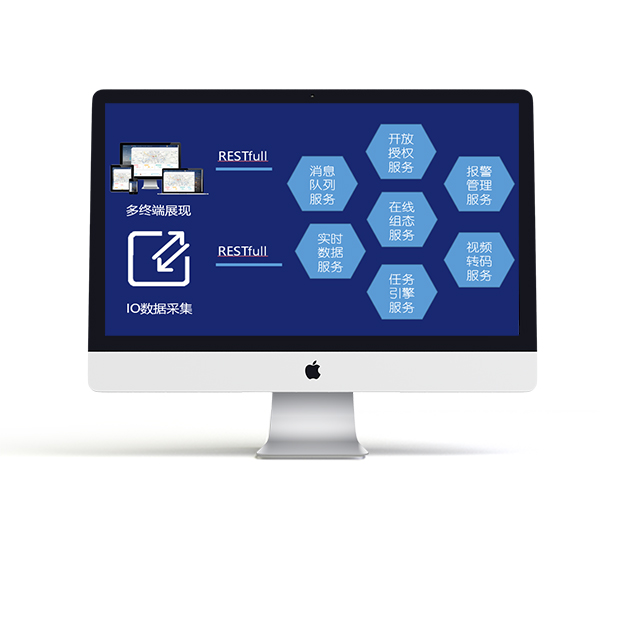
2.系统主要是在信息的获取、查询统计结果的呈现、科学计算、仿真模拟、信息传递、警报告警等提供支持。具体实现是通过在数据库、地理信息、通信网络基础上开发一系列应用软件实现。
技术参数
SPECIFICATION产品特点:
1. 实现二维GIS、三维GIS联动多维综合定位,提供不同视角观察。
2.支持俯仰、顶视、仿真、环绕、近景等多种空间观测方式。
3.提供高程、通视、区域、坡度、界面、折线、路段等多种空间分析方法。
4. 通过监控点位置、高程数据、八区域云台角度校准实现火警高精度定位。
5. 蔓延预测、周边资源分析、指挥调度、灾损评估等功能为火灾扑救提供有效的技术支撑。
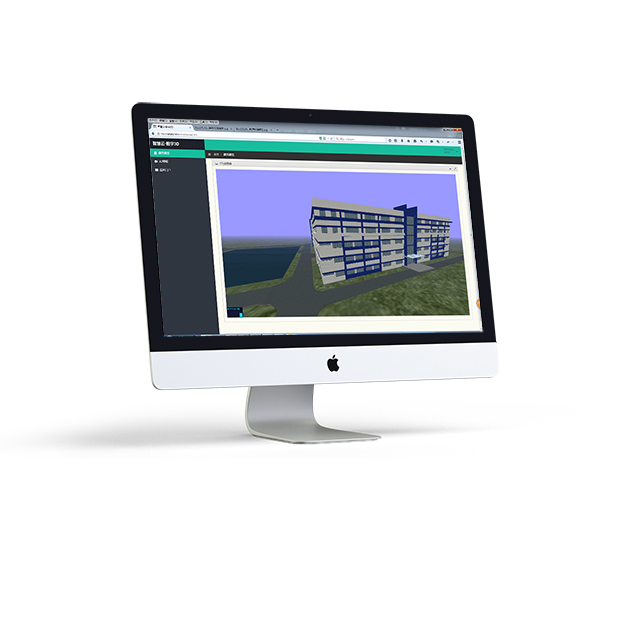
应用示例
APPLICATION EXAMPLESN热销产品
Hot Products
-
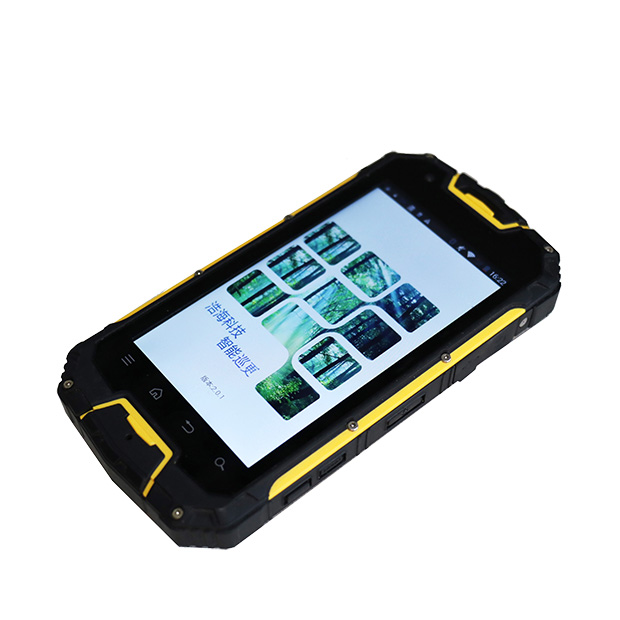
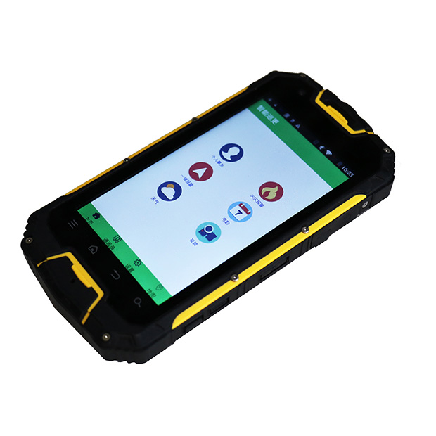
智能巡更管理系统
智能巡更管理系统可充当动态监测者角色,具有图片实时上传、拍摄小视频、获取实时天气状况、火情定位与管理、人员定位、人员巡更轨迹的查询与回放的功能特性,可以对巡防人员进行科学化管理,巡防人员可进行物品的申请、请消假等操作,系统对人员的考勤进行统计、分析并形成报表。智能巡更系统支持地图的基本操作、图层管理、数据采集等操作,可以对监控区域资源进行有效管理。
查看详情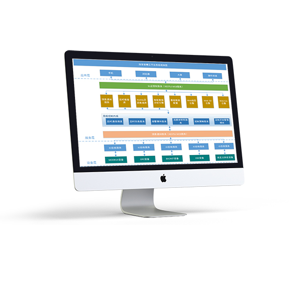
智慧管廊综合管理平台
浩海智慧管廊综合管理平台通过先进的云计算、大数据、物联网等计算机技术、网络技术、通信技术和管理技术,将三维地理信息、设备运行信息、环境信息、安全防范信息、视频图像、预警报警信号、管理信息等内容进行融合,形成一个协同作用的管廊运营监控整合平台。
查看详情


青岛浩海网络科技股份有限公司
股票代码:430695
- 0532-87920299
- 0532-87920299
- haohai@ehaohai.com
- www.ehaohai.com
- 经营地址:青岛市市北区人工智能产业集聚区4号楼

技术支持: 青岛网站建设